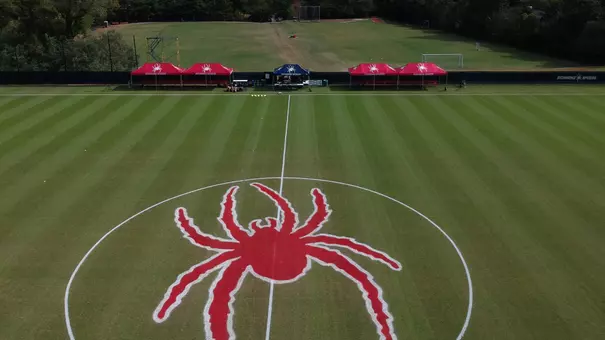
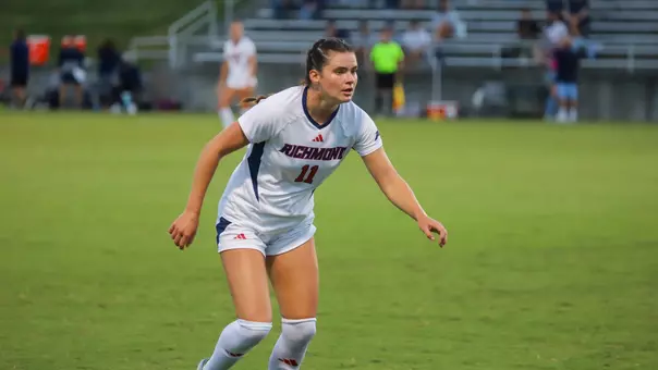
University of Richmond Athletics
Follow the 2001 Spiders - Home and AWAY!
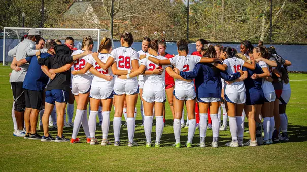
08/13/2001 | Women's Soccer
The Spiders are new to the Atlantic 10 conference. Assistant Coach Brianne Smithson is new to the Spiders' women's soccer program. So, she figured, it only made sense to know where she was going.
Coach Smithson found directions for every game on this year's schedule. She'll be there. Now, you can be there, too, cheering on the 2001 Spiders women's soccer team...
UNIVERSITY OF RICHMOND - Richmond, VA
From the North:
From the South:
From the East:
DUKE - Durham, NC
From the North:
From the South:
From the Airport:
CLEMSON - Clemson, SC
From the North:,
From the South:
UNIVERSITY OF MARYLAND - College Park, MD
From Baltimore and Points North:
From Virginia and Points South:
From Virginia and Points West:
From Annapolis and Points East:
From Washington, D.C. (Northwest/Southwest):
From Washington, D.C. (Northeast/Southeast):
GEORGE MASON UNIVERSITY - Fairfax, VA
From the North Using Route 495 to Route 66:
To Recreation Sports Complex/Field House Using Braddock Road:
From the South (Richmond, Norfolk, North Carolina):
From the Southwest (Harrisonburg, Roanoke, Blacksburg):
From National Airport:
From Dulles Airport:
JAMES MADISON UNIVERSITY
- Harrisonburg, VA
FORDHAM UNIVERSITY - ROSE HILL CAMPUS
- Bronx, NY
By Bus From the South/New Jersey:
By Bus From Long Island/Queens and Brooklyn:
By Car From Long Island/Queens and Brooklyn:
From Manhattan:
West Side:
From the North:
From the South/New Jersey:
From the East:
LA SALLE UNIVERSITY
- Philadelphia, PA
Directions from NY, Northern NJ, New England:
Directions from the North:
From the South:
Directions from the Blue Route (North and South) 476:
From the East:
From the West:
From 76 East & West, to the Campus:
ST. BONAVENTURE UNIVERSITY - Saint Bonaventure, NY
Buffalo, NY
DUQUESNE UNIVERSITY
- Pittsburgh, PA
ROUTE 80
ROUTE 76 PA TURNPIKE EASTBOUND
ROUTE 70 EAST
ROUTE 279 SOUTH (579 SOUTH)
ROUTE 279 NORTH, EXIT 14 PARKWAY WEST
ROUTE 76 PA TURNPIKE WESTBOUND
ROUTE 51
FROM THE PITTSBURGH INTERNATIONAL AIRPORT
FIRST MARKET STADIUM
95 South to 64 West (Exit 79). Take Glenside Drive Exit (Exit 183A). At the fourth stoplight, turn left on Three Chopt Road. After approximately a half mile, turn right onto Boatwright Drive. Bear right at the bottom of the hill. The Robins Center and First Market Stadium are on the immediate left. Pitt Field is located next to the large parking lot adjacent to the Robins Center.
95 North to 64 West. Take Glenside Drive Exit (Exit 183A). At the fourth stoplight, turn left on Three Chopt Road. After approximately a half mile, turn right onto Boatwright Drive. Bear right at the bottom of the hill. The Robins Center and First Market Stadium are on the immediate left. Pitt Field is located next to the large parking lot adjacent to the Robins Center.
Take 64 West. Take Glenside Drive Exit (Exit 183A). At the fourth stoplight, turn left on Three Chopt Road. After approximately a half mile, turn right onto Boatwright Drive. Bear right at the bottom of the hill. The Robins Center and First Market Stadium are on the immediate left. Pitt Field is located next to the large parking lot adjacent to the Robins Center.
KOSKINEN STADIUM
Take I-85 South to Highway 15-501 South in Durham. Exit Highway 751. Turn left at light. Proceed through three lights, take left on Science Drive. Proceed to second road, Whitford Drive, turn right. On your left hand side - Coombs Field (Baseball) and Cameron Indoor Stadium. On your right hand side - Koskinen Stadium (Soccer & Lacrosse) and Wallace Wade Stadium.
Take I-85 North to Highway 751 exit about 5 miles before City of Durham limits. Proceed until stop light, turn right on Highway 751. Drive approximately 3 miles, on fourth stop light - take left on Science Drive. Proceed to second road, Whitford Drive, turn right. On your left hand side - Coombs Field (Baseball) and Cameron Indoor Stadium. On your right hand side - Koskinen Stadium (Soccer & Lacrosse) and Wallace Wade Stadium.
Take I-40 West to Highway 147 (Durham Freeway). Proceed approx. 10 miles to Chapel Hill Street in downtown Durham. Turn right (loops over highway) and proceed to dead end - Highway 751. Turn right on 751. Proceed to first light - turn right on Science Drive. Proceed to second road, Whitford Drive, turn right. On your left hand side - Coombs Field (Baseball) and Cameron Indoor Stadium. On your right hand side - Koskinen Stadium (Soccer & Lacrosse) and Wallace Wade Stadium.
RIGGS FIELD
(from Charlotte, NC: 2.5 hours, Greenville, SC: 1 hour)
Take I-85 south to exit #19B (Hwy. 76/28 west). Exit toward Clemson University. Follow Hwy. 76/28 west for approximately 12 miles (through 7 traffic lights), and exit off onto Hwy. 93 south towards Clemson University. There are two ramps here, take the second one, under the bridge. Once on Hwy. 93, travel approximately 1 mile, passing Riggs Field on the left, to the fifth traffic light. Take a left at the light onto Williamson Road. Take the first left onto Heisman Street. Parking is located on both sides of Heisman Street.
(from Atlanta, GA 2.5 hours)
Take I-85 north to exit #14 (Hwy. 187). Turn left onto Hwy. 187 toward Pendleton, and proceed approximately six miles until the highway ends at Hwy. 76/28 (at the traffic light). Turn left and follow Hwy 76/28 west for approximately 6 miles, and exit off onto Hwy 93 south towards Clemson University. There are two ramps here, take the second one, under the bridge. Once on Hwy. 93, travel approximately 1 mile, passing Riggs Field on the left, to the fifth traffic light. Take a left at the light onto Williamson Road. Take the first left onto Heisman Street. Parking is located on both sides of Heisman Street.
LUDWIG FIELD - The field is located directly adjacent to Parking Lot 1 and close to the University Boulevard entrance.
Take I-95 South to Washington, D.C.'s Capital Beltway (I-495). Take Exit 27 and then follow signs to Exit 25 (U.S. 1 South toward College Park). Proceed approximately two miles south on U.S. Route 1. Turn right into Visitor Center parking area.
Take I-95 North to Washington, D.C.'s Capital Beltway (I-495). Continue North on I-95/I-495 toward Baltimore. Take Exit 25 (U.S. 1 South toward College Park). Proceed approximately two miles south on U.S. Route 1. Turn right into Visitor Center parking area.
Take I-66 East or I-270 South to Washington, D.C.'s Capital Beltway (I-495). Go East on I-495 toward Baltimore/Silver Spring. Take Exit 25 (U.S. 1 South toward College Park). Proceed approximately two miles south on U.S. Route 1. Turn right into Visitor Center parking area.
Take U.S. 50 to Washington, D.C.'s Capital Beltway (I-495). Go North on I-95/I-495 toward Baltimore. Take Exit 25 (U.S. 1 South toward College Park). Proceed approximately two miles south on U.S. Route 1. Turn right into Visitor Center parking area.
Take 16th St. North which becomes Georgia Ave. North at Maryland/D.C. line. Go East on I-495 toward Baltimore. Take Exit 25 (U.S. 1 South toward College Park). Proceed approximately two miles south on U.S. Route 1. Turn right into Visitor Center parking area.
Take Rhode Island Ave. (U.S. 1 North), which becomes Baltimore Ave. North at Maryland/D.C. line. Proceed through the city of College Park. Turn left at Rossborough Lane into Visitor Center parking area.
GMU STADIUM-
** Go through traffic signal at Braddock Road ** At next traffic signal, left onto University Drive
** Recreation Sports Complex is first building on left, with plenty of free parking **Field to right of RSC
(Philadelphia, Baltimore)
** I-95 South (stay on I-95 and take tunnel [$1 toll] if coming from north of Baltimore)
** Exit 27 -- I-495 West (sign will say Silver Spring) ** Cross Potomac River into Virginia
** Exit 49A -- I-66 West (Front Royal) ** Exit 60 -- 123 South (Fairfax)
** Go through 6 traffic lights. At 7th light take a right onto University Drive.
** Field House will be on the left and the soccer/lacrosse field is to the right of the field house.
** Exit 54 -- Rte. 620 (Braddock Road WEST)
** Go 5-6 miles to George Mason campus on right
** At traffic signal, right onto Ox Road (Rte. 123)
** At next traffic signal, left onto University Drive
** Recreation Sports Complex is first building on left, with plenty of free parking
** Field to right of RSC
** I-95 North (take I-295 North to avoid congestion if below Richmond)
** Exit 160 B -Rte.123 (sign will say Occoquan/Lake Ridge)
** Go approximately 15 miles to intersection with Braddock Road
** I-81 North ** I-66 East ** Exit 55 -- Fairfax County Parkway SOUTH
** Exit at Braddock Road, turn left at traffic signal at bottom of ramp
** Go approximately 3˝ miles to intersection with Ox Road/Rt.123
** I-395 South ** I-495 West ** Exit 54A -- Rte. 620 (Braddock Road WEST)
** Go 5-6 miles to George Mason campus on right
** Dulles Toll Road EAST ** Fairfax County Parkway SOUTH
** Exit at Braddock Road, turn left at traffic signal at bottom of ramp
** Go approximately 3˝ miles to intersection with Braddock Road
RESERVOIR STREET FIELDS
From Interstate 81, take Exit 245, Port Republic Road. Turn east onto Port Republic Road and take the first left (after the I-81 overpass) onto Forest Hill Road. At the first stop sign, turn left onto University Blvd.
Follow University Blvd. for approximately 1.3 miles, passing the JMU Convocation Center and the JMU Arboretum. At the first stoplight, turn left onto Reservoir Street. The first left leads to the field.
EDWARDS PARADE (Soccer): As you enter campus, parking lot is on your left. The football field, Jack Coffey Field, is immediately on your right and Edwards Parade is directly across the street.
Take the George Washington Bridge to the Henry Hudson Parkway/Saw Mill River Parkway North. Exit at Mosholu Parkway. Take Mosholu Parkway to end. Make a right onto Kazmiroff Blvd. (Southern Boulevard). Turn right at the third light into campus.
Take either the Throgs Necks Bridge or the Whitestone Bridge. After bridge follow signs for the Cross Bronx Expressway. Take Cross Bronx to the Bronx River Parkway, and take Bronx River to the Fordham Road exit. Bear right up a small hill as the road splits following the underpass, then make a right at the light (Southern Boulevard). Turn left at the next light into the main parking lot.
Take either the Throgs Neck Bridge or Whitestone Bridge to the Hutchinson River Parkway North to the Pelham Parkway West. Take Pelham Parkway for approximately two miles until the road splits following the Bronx River Parkway Underpass. Stay right up a small hill and make a right at the light (Kazmiroff/Southern Boulevard). Turn left at the next light into the main parking lot.
East Side: Take the F.D. Roosevelt Dr. to the Triborough Bridge. After crossing bridge, follow the Bruckner Expressway to the Bronx River Parkway. Take Bronx River Parkway to Fordham Road Exit (7W). Bear right up a small hill as the road splits following the underpass, then make a right at the light (Kazmiroff/Southern Blvd.) Turn left at next light into the main parking lot.
Take the Henry Hudson (West Side) Highway to the Mosholu Parkway Exit. Take Mosholu Parkway to end. Make a right onto Kazmiroff Blvd. (Southern Boulevard). Turn right at the third light into campus.
Take I-95 South to the Pelham Parkway West (Exit 8c). Take Pelham Parkway for approximately two miles until the road splits following the Bronx River Parkway underpass. Stay right up a small hill and make a right at the light (Kazmiroff/Southern Boulevard). Turn left at the next light into the main parking lot.
If traveling by bus, take the George Washington Bridge to the Henry Hudson Parkway/Saw Mill River Parkway North. Exit at Mosholu Parkway. Take Mosholu Parkway to end. Make a right onto Kazmiroff Blvd. (Southern Boulevard). Turn right at the third light into campus. If traveling by car, take the GWB to the Cross Bronx Expressway. Take Cross Bronx Expressway to Bronx River Parkway, and take Bronx River Parkway to Fordham Road Exit (7W). Bear right up a small hill as the road splits following the underpass, then make a right at the light (Kazmiroff/Southern Blvd.) Turn left at next light into the main parking lot.
Take either the Throgs Neck Bridge or Whitestone Bridge, and after bridge follow signs for the Cross Bronx Expressway. Take the Cross Bronx Expressway to the Bronx River Parkway, and take the Bronx River to the Fordham Road exit. Bear right up a small hill as the road splits following the underpass, then make a right at the light (Kazmiroff/Southern Boulevard).
Turn left at the next light into the main parking lot.
McCARTHY STADIUM - located on 20th Street
I-95 South to NJ Turnpike South to Exit 6 (connection to PA Turnpike), follow PA Turnpike to Exit 26 (Ft. Washington exit), to Route 309 south, 309 South becomes Ogontz Avenue. Follow Ogontz for approximately 5 miles until intersection of Ogontz and Olney Avenues. Right on Olney Avenue to first light, Left onto 20th Street. La Salle University is on the left corner.
I-95 South to Route I-676 West (Vine Street Expressway), to Route 76 West. To continue, see directions from Route 76 West.
I-95 North to Route I-676 West (Vine Street Expressway), to Route 76 West.
To continue, see directions from Route 76 West.
Blue Route (476) to Route 76 East. To continue, see directions from Route 76 East.
Route 42 West to Walt Whitman Bridge, from the bridge, follow Route 76 West. To continue, see directions from Route 76 West.
PA Turnpike East to Exit 24 (Route 76 East/West, Valley Forge). To continue, see directions from Route 76 East. Take 76 East.
West to Roosevelt Boulevard/Expressway (Route 1 North). Follow Roosevelt Boulevard/Expressway. Exit at Broad Street (Route 611) (MCI sign prior to exit).Make a left at the end of the ramp. Follow Broad Street (Route 611) North. Continue on 611 North to Sommerville. Make a left onto Sommerville. Follow to dead end. Make a right at the dead end onto Ogontz. Go to the second light (Olney Avenue). (Central High School is on the left corner) Make a left onto Olney Ave. Follow to the next traffic light (20th Street). La Salle University is on the left corner.
McGRAW-JENNINGS FIELD
1 hr, 45 min. South on Rt. 219 to Salamanca, then East on Rt. 17 to exit 24. or South on Rt. 400, then South on Rt. 16 to Rt. 417 West.
New York City, NY
7 hrs Across the George Washington Bridge to I-80 West. Stay on I-80 West until Rt. 380West, then go North on Rt. I-81 to Rt. 17. Go west on Rt. 17 to exit 24.
Pittsburgh, PA
4 hrs North on Rt. 79 to Rt. I-80, then East on Rt. I-80 to Rt. 219. Take Rt. 219 North to Rt. 17, then go East on Rt. 17 to exit 24.
Rochester, NY
2 hrs, 15 min. South on Rt. I-390 to Dansville, then take Rt. 36 South to Arkport. Take Rt. 17 West to exit 24.
Syracuse & Utica, NY
4 hrs West on Rt. I-90 (NYS Thruway) to Geneva, NY, then South on Rt. 14 to Rt. 54. Take Rt. 54 South to Rt. 17, go West to exit 24.
Albany, NY
5 hrs West on Rt. I-90 (NYS Thruway) to Rt. 88 South (Binghamton), then take Rt. 17 West to exit 24.
New Jersey
7 hrs Take Rt. I-80 West to Rt. 380 West to Scranton,PA. Pick up Rt. I-81 North to Binghamton, NY,then take Rt. 17 West to exit 24.
Philadelphia, PA
6.5 hrs, Take NE Extension (Rt. 9) of PA Turnpike to the last exit at Scranton, PA then pick up Rt. I-81 North to Binghamton,NY. Take Rt. 17 West to exit 24.
Erie, PA
1.5 hrs, East on Rt. I-90 to Rt. 17, then East on Rt. 17 to exit 24.
Cleveland, OH
3.5 hrs. East on Rt. I-90 to Rt. 17, then East on Rt. 17 to exit 24.
Danbury, CT
6 hrs West on Rt. I-84 toward Brewster, NY, then take Rt. 17 West to exit 24.
Washington, D.C.
6 hrs Take Rt. 270 North to Rt. 15. Follow Rt. 15 North to Corning, New York, then pick up Rt. 17 West to exit 24.
ROONEY FIELD
Follow Route 80 to Route 79 South. From Route 79, proceed to Exit 21, Pittsburgh/279 South. Follow 279 South approximately 15 miles to Exit 14, 579 South/Veteran's Bridge, look for and follow all signals indicating Civic Arena. Proceed to the traffic light and turn right onto Washington Place. Proceed through the next two intersections. At the second intersection, turn left onto Forbes Avenue. Take a right into the Duquesne University parking garage.
Follow Route 76 West to Exit 3, Mars/Pittsburgh/Route 79. Follow Route 79 South to Exit 21, Pittsburgh/279 South. Follow 279 South approximately 15 miles to Exit 14, 579 South/Veteran's Bridge, look for and follow all signals indicating Civic Arena. Proceed to the traffic light and turn right onto Washington Place. Proceed through the next two intersections. At the second intersection, turn left onto Forbes Avenue. Take a right into the Duquesne University parking garage.
Follow Route 70 East to Route 79 North. From Route 79, proceed to Exit 14, Pittsburgh/279 North. Follow 279 North for approximately 7 miles through the Fort Pitt Tunnels, staying in the right lane as you approach the tunnels. Follow the sign for Monroeville/376 as you cross the Fort Pitt Bridge. Proceed approximately two tenths of a mile to the Grant Street Exit #3. Proceed on Grant Street to the fifth traffic light at Forbes Avenue. Turn right onto Forbes Avenue. The Duquesne University parking garage is approximately 2 of a mile on your right.
Follow 279 South approximately 15 miles to Exit 14, 579 South/Veteran's Bridge, look for and follow all signals indicating Civic Arena. Proceed to the traffic light and turn right onto Washington Place. Proceed through the next two intersections. At the second intersection, turn left onto Forbes Avenue. Take a right into the Duquesne University parking garage.
Follow 279 North for approximately 7 miles through the Fort Pitt Tunnels, staying in the right lane as you approach the tunnels. Follow the sign for Monroeville/376 as you cross the Fort Pitt Bridge. Proceed approximately two tenths of a mile to the Grant Street Exit #3. Proceed on Grant Street to the fifth traffic light at Forbes Avenue. Turn right onto Forbes Avenue. The Duquesne University parking garage is approximately 2 of a mile on your right.
Follow Route 76 West to Exit 6, Pittsburgh/Monroeville route 376. Proceed on Route 376 approximately 12 miles to Exit 6, Blvd. of the Allies. Continue on the Blvd. of the Allies approximately 1 mile staying in the right lane. The Blvd. divides into a Y, as you pass Mercy Hospital. Follow the far right lane to the stop sign. Proceed straight ahead to Bluff Street and the Duquesne campus. At the intersection of Bluff Street and McAnulty Drive, turn right down the hill. Proceed through the stop sign, at the light turn right onto Forbes Avenue. Take a right into the Duquesne University visitor's parking garage.
Locate the appropriate route to Route 51. Follow Route 51 North to the Liberty Tunnels (you will turn right to go through the tunnels). Proceed through the tunnels and across the Liberty Bridge. Follow the signs for Forbes Avenue and Downtown. At the traffic light, turn right onto Forbes Avenue. Go through two more traffic lights. After the second set of lights, take a right into the Duquesne University visitor's parking garage.
The Airlines Transportation Company shuttle bus departs from the lower level of the airport every half hour and drops visitors at hotels in downtown Pittsburgh. From most hotels in Downtown, Duquesne is about a 10-15 minute walk, though it would probably be more convenient to take a cab ride (about $3.00) from the hotel to the campus. The shuttle bus will cost about $10.00. The trip to or from the Airport takes approximately 45 minutes. Cab service from the airport into Pittsburgh is approximately $30.00 and takes approximately 45 minutes.
From the Airport, the PATransit 28X Airport Flyer bus is available for $1.95 one way. The bus departs from the airport approximately every 45 minutes at the lower level bus stop. It drops visitors off in Downtown Pittsburgh.